Municipalities of biliran
Explore the municipalities of Biliran, where rich history, stunning landscapes, and vibrant local cultures come together. From scenic coastal towns to lush inland areas, each municipality offers unique experiences, heritage, and natural beauty, making Biliran a hidden gem for travelers and locals alike.
Discover the Unique Stories and Destinations of Each Municipality
Each municipality within Biliran holds its own unique charm, from lush landscapes and scenic coastlines to bustling town centers and hidden natural wonders. Click on any municipality below to discover its story, attractions, and the experiences it offers.
The first settlers of Almeria came from Jagna, Bohol. Originally bound for Samar, they were forced ashore by a typhoon and landed on a fertile, resource-rich land they decided to call home. They initially named the settlement Bagongbong, later changed to Solano in honor of their first chieftain, Capitan Solano.
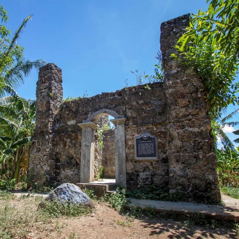
In 1834, a Spanish missionary named the area Almeria after his hometown in Spain, inspired by the locals’ hospitality. The Spanish built a watchtower on Baluarte Hill to guard against moro raiders and a Roman Catholic chapel. Almeria became an official municipality in 1886.
A religious dispute during the American occupation led to a temporary relocation of the municipal seat to Kawayan in 1907. Almeria remained under Kawayan’s jurisdiction until September 1, 1948, when President Elpidio Quirino restored its status as an independent municipality through Executive Order 292, ending the long-standing dispute.
Almeria is one of the eight (8) municipalities comprising Biliran Province. It is situated in the northwestern part of Biliran Island. Its geographic location has coordinates of 12425’E latitude and 11°40’N longitude. It is located eight (8) kilometers north of Naval, the capital town of the province. The town is situated at the mouth of Biliran Strait and faces the Visayan Sea. It is bound between the town of Naval on the south and on the north by the town of Kawayan and on the east by the tow of Culaba.
- Income Class: 5th Class Municipality
- Population Density per km2, (PSA, 2020): 2.20
- Barangay Count: 13
- Climate: Wet and Dry
- Water Supply: Spring
- Power Source: BILECO
- Transportation: Buses, Jeepney, Motorcycles
- Communication Facilities: Smart, Globe
- Postal Code: 6567
- Location (coordinates): 11DEG.28’19”N | 124DEG.34’30”E
- Official Contact Details: 0930 586 4528
Biliran gets its name from “borobiliran,” a native grass that once grew abundantly on the island. Early settlers, seeking refuge from moro pirates, established a community here, and by 1878, Biliran became an official municipality. It served as the religious, cultural, and political hub of the island until Naval became the capital in 1960.
Biliran remains a transit hub, connecting Leyte, Cebu, Samar, Luzon, and Mindanao through its road and sea networks. Buses, jeepneys, and pump boats provide regular transport, and a new provincial airport is under construction near Naval.
With reliable power from the Tongonan Geothermal Plant and abundant water resources, Biliran supports agriculture and provides potable water to all residents. Communication is maintained through radio-telegraph and handheld radios in each barangay, along with postal and telecom services.
The town has eleven schools, including the Biliran National Agricultural College, which offers elementary, secondary, and tertiary education.
Biliran is the oldest town in Biliran Island hence the whole island was named after it. It is located on the southwestern part of the island directly in front of Calubian, Leyte across the Biliran strait. The Development of the Municipality started when the Biliran Bridge was constructed connecting the mainland of Leyte. Transportation facilities in the whole Island has improved. Later on in the early part of 1980’s, the energization of the whole island was realized; thereby the economy of the island province including its municipality has improved.
Income Class: 5th Class Municipality
Population Density per km2, (PSA, 2020): 205
Barangay Count: 11
Climate: Wet and Dry
Water Supply: Biliran Waterworks System
Power Source: BILECO
Transportation: Van, Jeepneys, Tri-Sikad, Mocab, Tricycle
Communication Facilities: Smart, Globe
Postal Code: 6566
Location (coordinates): 11DEG.27’56”N | 124DEG.27’56”E
Official Contact Details: municipalityofbiliran@gmail.com
The coastal town of Cabucgayan on Biliran Island, now home to nearly 20,000 people, was founded by settlers from Biliran and Barugo, Leyte, in 1850. These pioneers, including the Cordeta family, built a protective watchtower against moro pirates, still visible today near the old church. They named the area Esperanza, which flourished with abundant crops and attracted settlers.
Esperanza became a municipality under Spanish rule, and the American government recognized it after the Philippine-American War. Later, the town was renamed Cabucgayan, after the shell-rich Bucgay River. Due to local conflicts, Cabucgayan briefly lost its municipal status in 1904, being annexed to Caibiran, but was returned to Biliran in 1910.
Persistent residents formed the Macabugwas Society in 1948, led by community leaders, to advocate for full municipal independence. Despite many political challenges, their petition reached key leaders, including President Elpidio Quirino. Finally, on September 29, 1949, Executive Order No. 271 granted Cabucgayan independence, officially reinstated as a municipality on November 25, 1949.
The coastal municipality has a land area of 54.19 square kilometers or 20.92 square miles which constitutes 10.11% of Biliran’s total area. Its population was 21,542, as determined by the 2020 Census. This represented 12.01% of the total population of Biliran province. Based on these figures, the population density is computed at 398 inhabitants per square kilometer or 1,030 inhabitants per square mile.
- Income Class: 5th Class Municipality
- Population Density per km2, (PSA, 2020): 4
- Barangay Count: 13
- Climate: Wet and Dry
- Water Supply: Cabucgayan Water System
- Power Source: BILECO
- Transportation: Van, Jeepneys, Tri-Sikad, Mocab, Tricycle
- Communication Facilities: Smart, Globe
- Postal Code: 6567
- Location (coordinates): 11DEG.28’19”N | 124DEG.34’30”E
- Official Contact Details: +6392636604065
The town of Caibiran started from a group of immigrants from Leyte mainland. They settled near the mouth of the river four kilometers from the present town site. The river was teeming with a fish and abounded with lizards called “Ibid” which suggested the name Caibiran ( a place where there are plenty of “Ibid” ).
Caibiran gained the status of a pueblo. Erected were a limestone church and a watchtower . One day, due to excessive rains, the river overflowed its banks and destroyed the town, claiming lives and properties. Caibiran lived under the threat of the river.
In 1882, Captain Bebiano Maderazo led the people to a new site. The new settlement became a town while the previous site became a barrio of “Binongohan” meaning the place where the river overflowed its bank.
In 1950 part of the bounderies of Caibiran were incorporated into the other new municipalities. Three Barrios in the north were annexed to Kawayan. Culaba took with her a number a barrios and three southern barrios went to Cabucgayan.
Administration has been in succession since 1883 by seven “Capitanes”, seven “Presidentes” and ten Municipal Mayors.
Caibiran is a coastal municipality in the island province of Biliran. The municipality has a land area of 83.55 square kilometers or 32.26 square miles which constitutes 15.50% of Biliran’s total area. Its population as determined by the 2015 Census was 22,524. This represented 13.12% of the total population of Biliran province, or 0.51% of the overall population of the Eastern Visayas region. Based on these figures, the population density is computed at 270 inhabitants per square kilometer or 698 inhabitants per square mile.
- Income Class: 5th Class Municipality
- Population Density per km2, (PSA, 2020): 289
- Barangay Count: 17
- Climate: Wet and Dry
- Water Supply: Spring
- Power Source: BILECO
- Transportation: Buses, Jeepney, Motorcycles
- Communication Facilities: Smart, Globe
- Postal Code: 6565
- Location (coordinates): 11° 34′ North, 124° 35′ East (11.5723, 124.5813)
- Official Contact Details: 09952143270 / 09202566115
The pueblo has existed during the revolution time of 1899 and its location was in the northern side of Amambahag River and her name was Binongto-an. Due to its low lying elevation constant flooding devastated the place and the settlement was transferred to the southern part of Amambahag River near the legendary Culaba Brooks—where the new town got its name
On 1901 the pueblo was raided by pulahans, a marauder from the island of samar, taking away everything and destroyed the place by fire leaving it completely devastated with no single document left that will prove who were the Officiales del Pueblo on that time. The place was annexed to the neighboring town of Caibiran as one of its barrio.
In 1907 educational system was opened, utilizing the home of Capitan Pacifico Amable as grade one English class and eventually grade two was offered. After the time of Seńor Amable, Seńor Gervacio Abanilla succeeded as captain.
Growth was slow, but because the place was strategically located far from the troubled areas, migrants from nearby provinces of Cebu and Bohol came. Endowed with abundance of flora and fauna, trading of forest products such as lumber was established through sailboats locally known as paraw to the nearby and the farthest provinces of Cebu.
During the postwar, community leader clamored for the township of Barrio Culaba. Their efforts lasted for a decade until the time on 16 October 1953 when President Elpidio Quirino signed Executive Order No. 630 creating the Municipality of Culaba in the Province of Leyte, seceding the five original barrios of Pinamihagan, Habuhab,Culaba, Bool and Acaban from the mother Municipality of Caibiran. The inauguration of the new town was on 16 January 1954, the incumbent mayor of Caibiran Mayor Gerardo Pazon Sabarre, a native of Culaba, was appointed as new mayor and the seat of the government was in the old tribunal building which was located in the basketball court today.
Culaba is one of the eight (8) municipalities of Biliran. It was established on January 16, 1954 through Executive Order Number 630 signed by President Elpedio Qurino on October 16, 1953. The old site of the town located at the northern bank of Amambahag River where the structure of the church can still be traced. Because of constant floods and destructive typhoons that devastated the town, the people were forced to transfer to safer place where the set of local governance has established. The Municipality of Culaba is an agricultural area with coconut as the dominant crop followed by the rice, root crops and other crops. The people are engaged in trade, commerce, fishing and agriculture. The Municipality is located in the northeastern part of Biliran in Region 8. It is located approximately at coordinates at 11.39 degrees north latitude and 124.32 degrees East longitude, with a total area of 7,345.27 hectares and a total population of 14,326. It is classified as the fifth class municipality. It is bounded in the Northwest by the Municipality of Kawayan, South by the Municipality of Caibiran, East by Samar Sea, and West by the Municipalities of Naval and Almeria. The Municipality composes of 17 barangays and three of which are situated within the town proper.
- Income Class: 5th Class Municipality
- Population Density per km2, (PSA, 2020): 177
- Barangay Count: 17
- Climate: Wet and Dry
- Water Supply: Culaba Water System, Culaba Water District
- Power Source: BILECO
- Transportation: Van, Jeepneys, Tri-Sikad, Mocab, Tricycle
- Communication Facilities: Smart, Globe
- Postal Code: 6564
- Location (coordinates): 11DEG.64’41”N | 124DEG.51’96”E
In the 16th century, descendants of Lapu-Lapu from Cordova, Mactan, settled on the northern coast of Isla de Panamao (now Biliran). They built their village near the rocky hill of Subingsubing, using it as a lookout point against Moro invaders. This settlement, initially known as Barrio Telegrafo and later Barangay Balacson, attracted more Cebuano-speaking settlers.
As the population grew, some residents moved north, seeking fertile land and fresh water. They named the area Barrio Kawayan due to its dense bamboo cover. Kawayan became part of Almeria, a pueblo on the island.
During the Philippine Revolution, General Ambrocio Mojica visited Telegrafo and renamed it San Clemente after his son. Under American rule, a religious dispute prompted the transfer of the municipal seat from Almeria to Kawayan in 1907. Despite Almeria’s protests, a plebiscite confirmed Kawayan as the new center, deepening tensions between the two communities.
In 1938, Simplicio Jaguros became the first Municipal Mayor of Kawayan. During Maximo Salloman’s term, Almeria was granted separate township status by Executive Order 292, ending the Almeria-Kawayan divide in 1948. In 1951, neighboring areas from Caibiran were annexed, and in 1955, Kawayan was made a parish, celebrating its town fiesta in honor of Saint Raphael the Archangel.
The coastal municipality has a land area of 61.02 square kilometers or 23.56 square miles which constitutes 11.38% of Biliran’s total area. Its population was 20,455, as determined by the 2020 Census. This represented 11.41% of the total population of Biliran province. Based on these figures, the population density is computed at 335 inhabitants per square kilometer or 868 inhabitants per square mile.
- Income Class: 5th Class Municipality
- Population Density per km2, (PSA, 2020): 11.41
- Barangay Count: 20
- Climate: Wet and Dry
- Water Supply: Spring
- Power Source: BILECO
- Transportation: PUJ, PUV, Motorcycle, Habal-Habal
- Communication Facilities: Smart, Globe
- Postal Code: 6562
- Location (coordinates): 11° 41′ North, 124° 21′ East
- Official Contact Details: 09066086093
Maripipi, the northernmost part of Biliran, is a small island municipality with a 24-kilometer coastal circumference. Separated from Biliran by a narrow channel, Maripipi lies equidistant from Leyte, Samar, and Masbate. Due to its strategic position, Maripipi was a regular stop for Spanish galleons during colonial times, serving as a crucial link in the Luzon-Visayas trade route.
Originally named Isla Rosa, the island is steeped in legend, with locals believing it to be the burial site of lovers Maria and Pepe, who tragically took their own lives after fleeing from Maria’s disapproving family. Maripipi is also considered an extinct volcano, which has left the island with rich, rocky soil ideal for coconut and rice cultivation. The island’s trade has long attracted merchants from Cebu, Bicol, Masbate, and Samar.
As early as 1595, Jesuit missionaries began visiting Maripipi’s pagan tribe. Impatient with the lack of local conversions, the chieftain led his entire clan to Tinago, Samar, to be baptized en masse. In later years, Maripipi suffered from Moro raids, prompting the community to set up hidden bamboo traps in the soil to protect against marauders.
Known for its abundant kaolin clay, Maripipi has become a pottery center, with nearly every household crafting clay products, from pots to flower vases. This ceramics industry has gained wide recognition, reaching markets as far as Mindanao. Once part of Naval, Maripipi became an official municipality in 1867, marking the start of its prominence as a center for craftsmanship in Biliran.
The island municipality has a land area of 27.83 square kilometers or 10.75 square miles which constitutes 5.19% of Biliran’s total area. Its population was 6,373, as determined by the 2020 Census. This represented 3.55% of the total population of Biliran province. Based on these figures, the population density is computed at 229 inhabitants per square kilometer or 593 inhabitants per square mile.
- Income Class: 5th Class Municipality
- Population Density per km2, (PSA 2020): 2.42
- Barangay Count: 15
- Climate: Wet and Dry
- Water Supply: Spring
- Power Source: NAPOCOR
- Transportation: Motorbanca, Motorcycle, Habal-habal
- Communication Facilities: Smart, Globe
- Postal Code: 6563
- Location (coordinates): 11° 47′ North, 124° 21′ East
- Official Contact Details: 09565498337

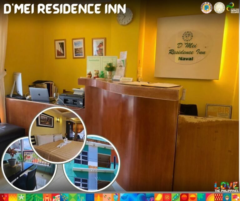
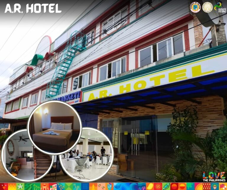
The early settlers of the Bagasumbol area, now known as Naval, were primarily Cebuanos from Danao, Cebu. Guided by Padre Inocentes Mangco Garcia, who was captivated by the fertile plains during his trips between Biliran and Almeria, these early settlers established a community in the latter half of the 18th century. Even before its settlement, this area was called “Bagazumbol,” derived from the Samareño term meaning “somewhat pointed,” a reference to the area’s pointed geographic features.
Over time, additional settlers arrived from Bohol, Panay, and Negros, and the land was divided among these groups. Cebuanos, including families like the Garcias, Mangcos, Gonzaleses, and Laudes, settled the land south of the main settlement, stretching toward Caraycaray. The Boholanos, such as the Jayubos and Enguitos, occupied land near the mountains, while the Ilonggos, including the Corveras and Zamoras, settled the northern regions near the Anas River.
To protect against Moro pirate attacks, the settlers constructed a warning system and a watchtower, or Lantawan, near the Caray-Caray River. This early settlement along the river was initially called Binongtoan, later renamed Caray-Caray. The community chose Our Lady of the Most Holy Rosary as their patron saint, initially celebrating the feast day in October until it was moved to January in 1928, allowing farmers to focus on the harvest season.
In May 1860, the area became an independent parish, with Padre Santos de Santa Juana as the first Cura Paroco. Under his guidance, the community built a Spanish-style church from coral stones, which stood until it was replaced in 1966 by a new structure under the leadership of Franciscan Missionaries, Fathers Miles Pfalser and John Brinkman. During the Spanish era, Bagasumbol served as a stronghold for the Spaniards amidst threats from Polahan rebels who posed a serious danger to the region.
The coastal municipality has a land area of 108.24 square kilometers or 41.79 square miles which constitutes 20.19% of Biliran’s total area. Its population was 58,187, as determined by the 2020 Census. This represented 32.45% of the total population of Biliran province. Based on these figures, the population density is computed at 538 inhabitants per square kilometer or 1,392 inhabitants per square mile.
- Income Class: 2nd Class Municipality
- Population Density per km2, (PSA, 2020): 2.83
- Barangay Count: 26
- Climate: Wet and Dry
- Water Supply: NWD
- Power Source: BILECO
- Transportation: Buses, PUJ, Motorcycles, PUV, Pedicabs, Tricycles, Vessels, MotorBoats
- Communication Facilities: Smart, Globe
- Postal Code: 6560
- Location (coordinates): 11° 34′ North, 124° 24′ East
- Official Contact Details: +635000487
